Canon
EOS 3, handheld
Sigma 24-135 at 35mm
Fuji Provia 100F
f11, 1/60 second
|
|
|
|
|
|
|
|
|
|
|
|
Canon
EOS 3, handheld |
| Now you know | |
 |
|
|
|
|
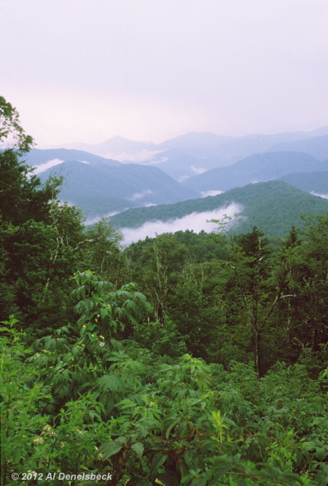
The mountain range that forms the western edge of North Carolina actually goes by two names: generally referred to as the Blue Ridge Mountains, it is also known as the Great Smoky Mountains, and this image illustrates the origins of both. North Carolina is a very humid state, so the successively more distant peaks that are easily visible from numerous locations in the mountains quickly take on a blue color cast due to atmospheric haze. But the higher elevations also serve to cool this humid air, producing frequent patches of fog, most especially after rains, and this can be seen drifting and rising between the peaks like smoke from valley campfires.
Despite the steep inclines in many places, the 'Blue Ridge Physiographic Province' is actually well eroded. Originally formed from the collision of the North American and African tectonic plates, many days (i.e. 450 million years) ago, they've been gradually wearing down since and most of the silicates within have flowed into the ocean, extending the shoreline outwards – in essence, the entire eastern half of the state is crumbled mountain. Even here in central NC a few hundred kilometers from the beach, most of the rocks are the same composition as the sand, just bigger. It's a beach in DIY form...