


I mentioned in the previous post about the possible explanation for the raised water levels in the pond, and The Girlfriend and I went out in the kayaks today to check things out. I would say the mystery is adequately solved.
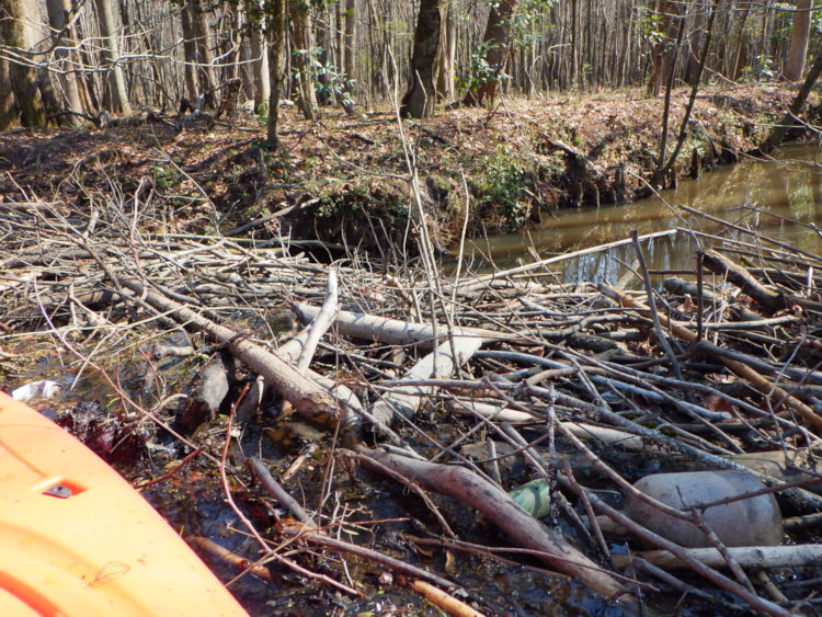
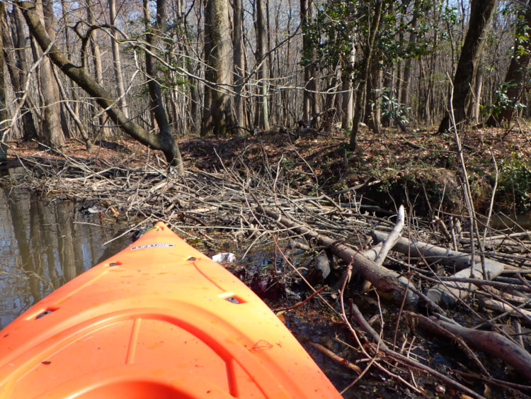
That’s the edge of the kayak peeking in there, as it sat against the top of an impressive beaver dam, one that measured better than six meters in length across the drainage channel, and a meter or more difference in the water levels on either side. I could only get one decent perspective on it without trying to get out of the kayak and schlep around on shore someplace (which may come another day,) but I think these are expressive enough.
We only own half of the portion of the pond that we refer to as ‘The Bayou,’ and this sits beyond that dividing line, so technically it’s someone else’s property. It’s also not on the pond itself per se, but on an offshoot to the east, in the direction of the creek that forms the eastern border. It raised a few questions, especially given that we’ve been told the ponds are manmade, and the evidence for this was there – we also got down to the far end of the uniformly-shaped (more or less) pool and found the outlet pipe there. That was higher than this water level though. and this dam was beyond a break in the bank. It was responsible for flooding a very large section, seeming to extend all the way across to the creek itself.
So, what had caused the gap in the banks that allowed this to occur in the first place? Or, as I’m surmising right now, had the beavers dammed only a tributary of the creek, one seen beyond the dam in the photos, and the water level eventually surmounted a low point in the bank between this tributary and The Bayou, causing the ponds to become backed up too? That’s my working hypothesis right now.
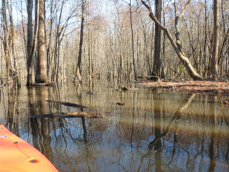
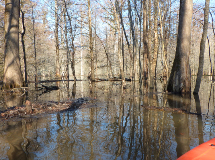
From the shallow depth and the logs and cypress knees everywhere, I suspect the area seen in these two pics had been forest floor until recently, perhaps a bit boggy but otherwise solid – it now looks more like the creek flooded its banks, and we could potentially have paddled right on into the creek. Which would also explain the significant increase in trash in our ponds, since this became wide open water between the creek (receiving trash from the typical inbred redneck assholes that have to hurl their shit off the bridge where the road crosses the creek upstream) and the ponds. Which also means that my idea for putting a trash barrier along one channel would be next to worthless, because it wasn’t actually coming in that way.
The lodge was quite close by too.
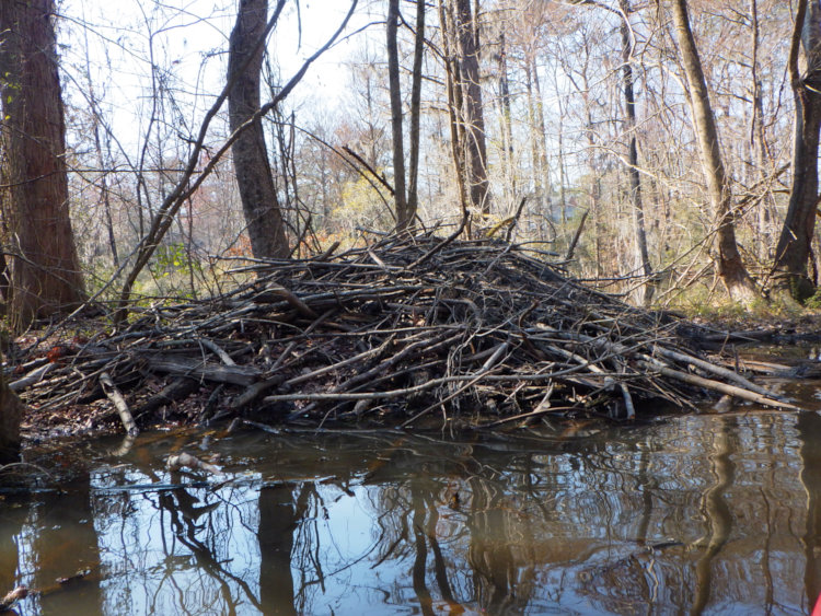
While we have two beaver lodges on the property, one potentially abandoned, it would seem they weren’t the source of all the cutting and gnawing activity we’ve been seeing of late, since this is better than twice the size of either one, being a meter or more in outside height and showing fresh cuttings in its structure.
Which is another interesting point. Every lodge that I’ve ever seen in North Carolina has been dug into the steep banks of a stream, pond, or lake, rather than freestanding. The living area of the lodge itself is above water but underground, even when the entry is always submerged to prevent predator access, and the steep banks and land height above water level on the creek side permitted this; the minimal rise of the land on the pond sides wouldn’t allow for a dry chamber above water. This is the first tall dam I’ve seen where the living chamber might actually have been constructed under that log dome rather than dug out, perhaps even extended higher as the water level rose.
While we seemed to have two beavers living in one of those lodges near us, this confirms that there are certainly more within reach, and likely coming up to the backyard pond to snag more saplings as needed. Now, will I be able to get more pics or videos of these? That might be tricky, since there is no walking access to the dam or lodge that I know of, nor could see the potential of from the kayak, so that means I’d likely have to pack the photo equipment into a watertight case and haul it down to a nice vantage, beach, unload, and set up – and at least the return trip would be in full darkness. Not inconceivable, but a lot of effort, and not something I should be doing alone. Don’t count on it, is what I’m saying – unless someone wants to pony up some funding for the resulting pics and video? Let’s talk.