


As hinted at earlier this week, we feature the first set of images from the blog’s official, um, Noncontiguous Correspondent, Jim Kramer, and his trip to Juneau, Alaska. We can’t really use the term “foreign” since it’s still the US, and even the continental part – I had opted for “discontiguous” but Merriam Webster tells me that’s incorrect. And truth be told, “correspondent” isn’t even working since he’s sent me roughly two dozen words in relation to these, due to a schedule that is best not examined closely. So any text herein, which will be minimal, is mine and subject to wild inaccuracies. I mean, even more so than normal…
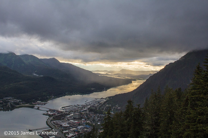
Alaska is many times the size of Texas while only one-tenth as egotistical (yet just as prone to grave errors in elected officials,) and Juneau is the unlikely placed capital, way down this little tail to the south and likely viewed as “not proper Alaska” by the residents in the rest of the state. I’m guessing, anyway. Juneau has every appearance of losing its share of the bed to the mountains, clinging desperately to the edge and having continual nightmares of falling off – in fact, the city continues around behind the mountain seen to the right, there being just enough room on the bed for a couple of roads and a shop that sells parachutes for hikers. The image above is taken from the vantage of Mt Roberts Nature Center, which is reached by a tramway visible below.
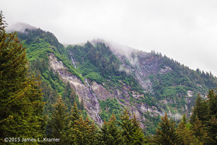
 I used the word, “precipitous,” in the teaser, and anyone that knows me can tell you that I don’t use that word lightly. Juneau is an area of ridiculously vertical landscapes, as are quite a few portions of Alaska – not a place where Frisbees are popular, I’m betting. But you can probably hang-glide to Seattle…
I cannot vouch for whether it is always this humid there, but I imagine it’s pretty frequent. I also imagine that the spring thaw season gets to be a real mess. I am not a cold weather person, but viewing these pics while we were in heat wave and drought conditions in NC was kind of pleasant.
Now, a small bit of info. The clouds seen in many of these pics seem quite low, but they may not be any lower than the clouds we see all the time – they only appear that way because the peaks are tall enough to jam through them. I had the experience one time of being in the Blue Ridge mountains of NC and seeing a thick fog boil in very dramatically. In moments it became clear it was not fog at all, but a storm cloud at ‘normal’ altitude, when the downpour began.
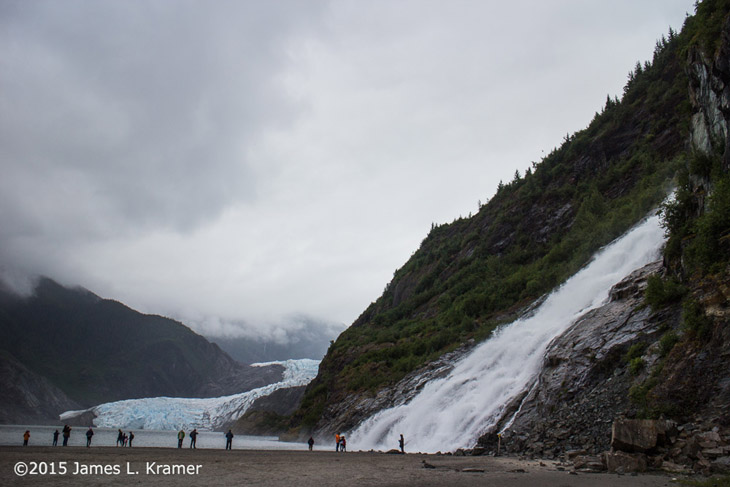
Now all of this is scenic enough, but right outside city limits, as it were, sits Mendenhall Glacier – actually, quite a few glaciers, if they can even be differentiated in any meaningful way, but Mendenhall is the one with easy access. Seriously, check it out in the mapping service of your choice – it’s a pretty dramatic landscape.
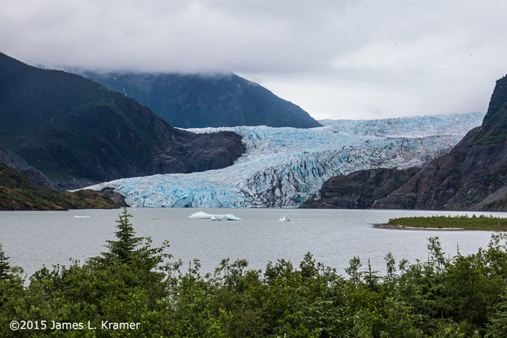
Scale is always a tricky thing with images like these, but to help you out, there are still trees on the slopes alongside the glacier. To help you out even more, it measures 650 meters (2,100 feet) across the base where it contacts the water. Look closely at the details and keep those figures in mind as we go on to the next photos.
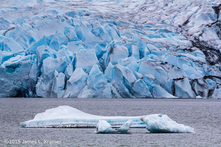
The colors and textures of the glacier are great, even in this muted light – perhaps they’re better because of it, letting more of the subtleties through without glare. I can’t help but wonder how old some of that snowpack is in there…
With a lot of math that I cannot do and perhaps a few details from Jim, I could estimate the size of that iceberg in the foreground. A faint hint may be gathered by comparing the ripples in the water, though it doesn’t help a lot, I admit. There’s a bit I can provide, however, even if I wouldn’t put any trust in my figures here: see the dark stain right dead-center on the glacier face, just a little above the center of the pic? That’s about 65 meters (215 feet) off the water, or roughly the height of a 21 story building.
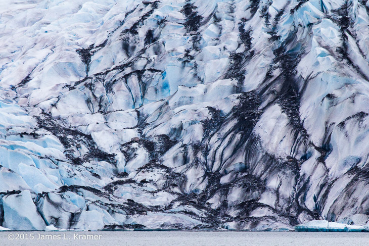
Even though this image overlaps the previous, you can see the difference in texture here, not just from the debris, but from the actual shape of the ice. I suspect a lot of it has to do with the fact that the darker debris absorbs more heat from sunlight and melts off the ice it contacts faster, smoothing away the surface more than splitting off icebergs, but that remains a guess.
By the way, this is a lake, with a tortuous path down to the bay – I have no idea how many icebergs actually make their way down to open water, but it’s quite a path to travel.
I have no idea whether any path exists up to the glacier itself, but from seeing these images, I suspect not – it would likely be treacherous as hell just getting to it, and the crevasses thereon not something you’d want to fall into. Though it presents some interesting speculations from an archeological point of view…
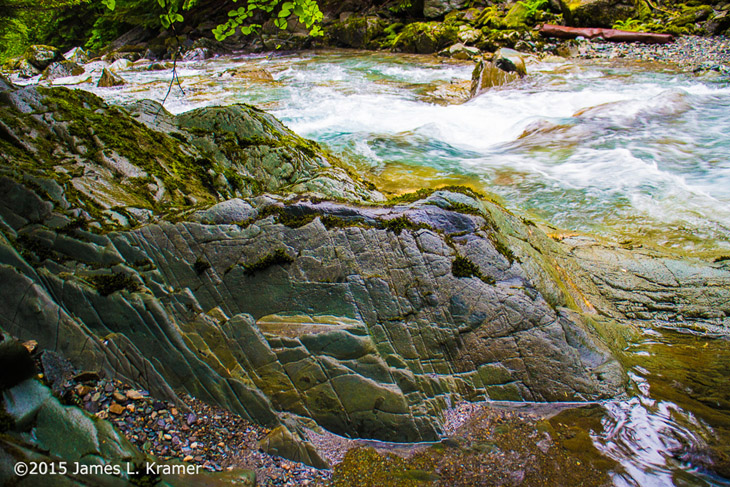
I will close with one of my favorite images from this batch, which Jim has not identified for me. Geologists out there can tell me what produces all those colors in the rock, especially the foreground pebbles, but for now I’m just going to enjoy them mixed with the different textures in the photo.
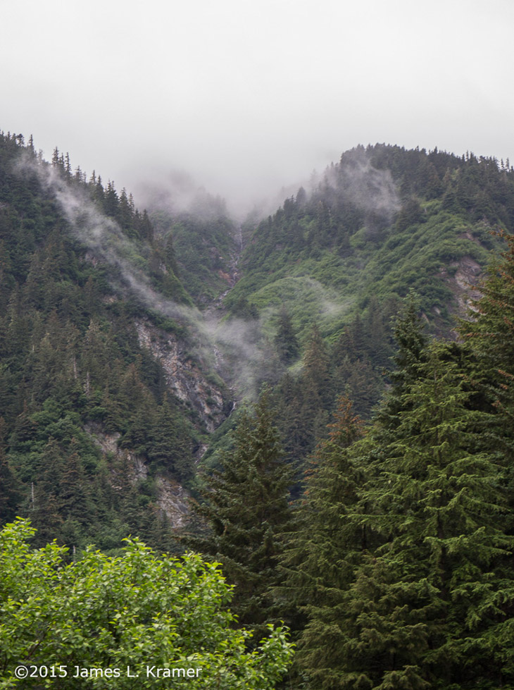
The first image was taken at the edge of “down town Juneau” Looking up towards Mount Juneau.
The second was taken at the Mount Robert’s Tramway station looking north.
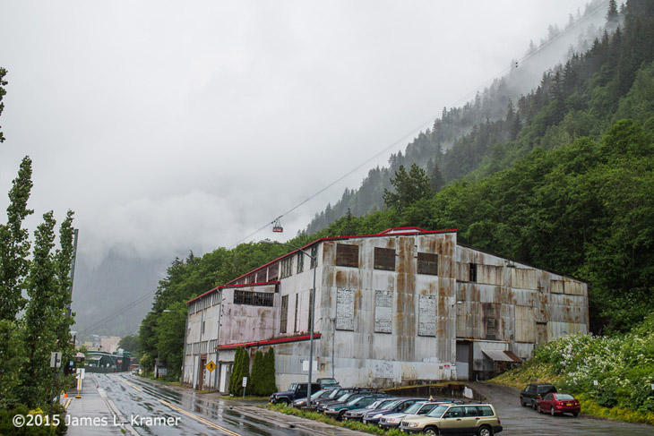
The Mount Robert’s Tramway owns the building in the third image. Marked with no trespassing signs every ten feet, interspersed with 24 hour video surveillance signs and the cameras to back it up. But what really threw me for a loop was the building roof which looked brand new, yet the walls looked like they had been there for fifty years. It is the entrance to the mine that has more miles of tunnels than there are paver roads in Juneau.
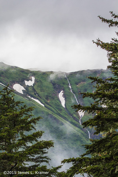
The fourth and fifth images were taken from the Mount Robert’s area at the top of the mountain looking east.
The next three glacier images were taken from the observation platform at the Glacier visitor center.
The next was taken at the terminus of the Gold Nugget Falls Trail. And thus the water cascade/falls.
The finale image was taken at gold creek just outside of Cope Park in Juneau proper.