N 34°51’19.93″ W 76°19’6.58″ Google Earth Location
This one’s a little fun in that, if you go to the location, it’s not technically there anymore. Well, it is, but storms between the time this was taken and now have radically reshaped the islands, and what was once inlet is now mid-island. Not only that, but reaching it takes a lot more effort.
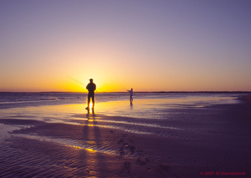
This came from a work-related fishing trip back in 1999, to what I believe is known as Portsmouth Island on the South Core Banks of North Carolina. To get there we had to use a four-wheel-drive vehicle and take a ferry, putting in at Long Point Cabin Camp, the offices of which should be noted in most map services further northeast on the island – I mean, what was the same island back then, since we drove down to the photo location. Fishing bores me to tears, so I treated the trip as a photo excursion instead, which didn’t net me a whole lot of great images due to bad weather most of the time, but at sunset it had cleared and produced these skies. This shows two of the guys I was there with, actually doing some fishing instead of drinking – I had to be lightning fast to catch it…
A few years later, storms had cut a new channel through the island and filled this one in – you can see the changes in the Google Earth program, though I haven’t found a way to see old photos from the online version. Then, subsequent storms did even more reshaping – and then more. Not a place I’d want to own property, especially since one good hurricane will scour the very low island clean. This is the nature of Atlantic barrier islands.
This is also the place where I found numerous paths through the beach grasses, wide enough for beavers though this wasn’t their habitat, and wondered about them. Awaiting the ferry back at the end of the weekend, I found out from a regular visitor that they were caused by “nutra” [sic], and kicked myself for not staking out some of them in the wee hours, because I’d heard of nutria but had never seen one. This would eventually be rectified 23 years later.


