


On Friday, September 6th, at 11:27 PM EDT, NASA will be launching the Lunar Atmosphere and Dust Environment Explorer (LADEE) satellite from the Wallops Island launch facility on the Virginia peninsula. Viewers on the east coast of the US may be able to see it as it heads towards lunar orbit, since night launches allow the exhaust plume to be seen from great distances. See the post at Universe Today for more details.
My location lies within the viewing range, but the launch vehicle will be less than 10° above the horizon, which is a total writeoff unless I find someplace elevated, or a big lake facing the right way. We’ll see what happens. Though it may be a while, since the following week is going to be a busy one and I may not have the chance to post any results – any posts that may appear then will likely have been scheduled ahead of time.
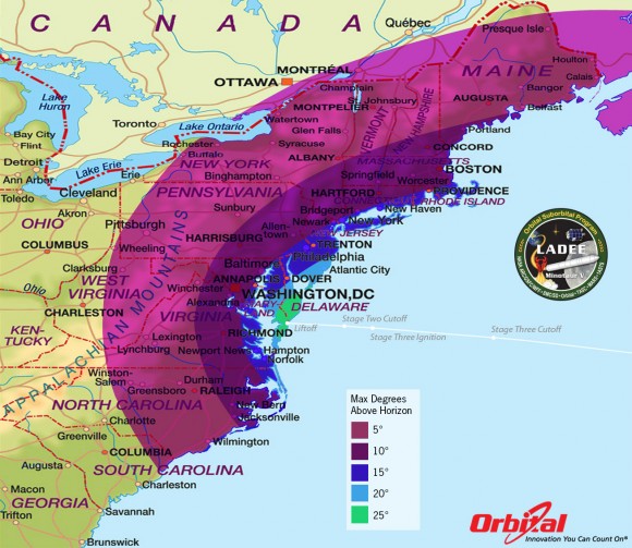
The LADEE nighttime launch will be visible to millions of spectators across a wide area of the Eastern US – weather permitting. This map shows the maximum elevation (degrees above the horizon) that the Minotaur V rocket will reach during the Sep. 6, 2013 launch depending on your location along the US east coast. Courtesy: Orbital Sciences
** Text shamelessly stolen from Universe Today
The Minotaur V launch vehicle is a new design, a five-stage unmanned rocket that will carry the LADEE satellite into orbital position around the moon. The lower stages are powered by solid fuel, which undoubtedly helps it to be visible along such a broad portion of the coast – liquid fuel boosters tend to burn with a clean flame and leave little smoke, while the solid fuels produce a highly visible exhaust that glows brightly much further from the nozzles; see here for a daylight comparison. The space shuttle used both, and if you look closely at any launch video or photos, the difference will be clear – it’s the solid-fuel boosters on the side that make all the smoke (though right at launch, the thick white clouds are actually steam from the launch suppression system that protected both pad and launch vehicle.)
Be aware that launch times often slip, so if you’re trying to see the vehicle crawl across the sky, it’s not a bad idea to stay connected to the mission site if you can – you’ll notice there’s a countdown clock on the page I linked to. Good luck!
A small, weird addition
While looking up the Wallops Island Launch Facility on Google Earth, I found a strange effect from the imagery dated 4/29/2010. A lot of people believe Google Earth uses all satellite images, but in truth most of them are taken from survey aircraft, and for some reason, the images used for that date all show the shadow of the aircraft, many times over. Either that, or a huge fleet of P3 Orions, some without tails, was going over at the time.
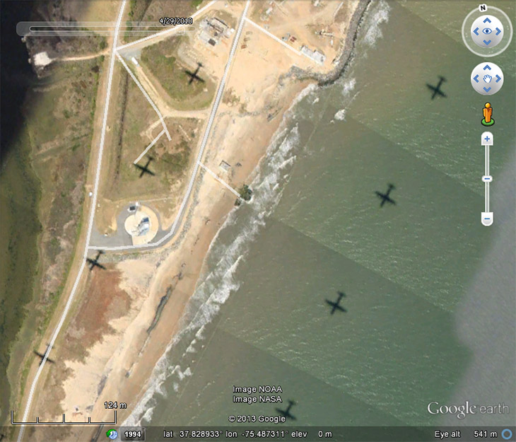
Yes, I think that’s the actual launch pad, middle left.