


N 35.888237° W 79.015528° Google Earth Placemark
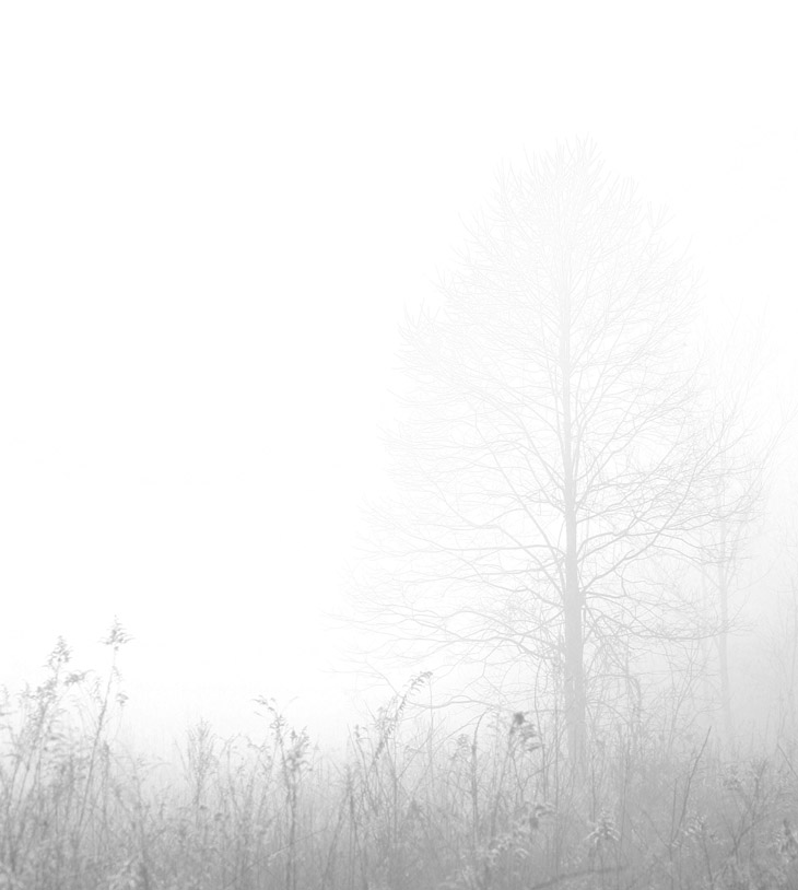
I should have done this one two weeks back, when it would only have been six years and three days after it was originally taken, but oh well. This was from January 2017, and there was still a smidgen of snow on the ground even though the morning’s temperatures were pretty nice for January – this is hinted at with the fog, but granted, the image here is also altered a bit from the original. This is just the red channel, which produced the nice thin results that I liked, though the original wasn’t terribly far away from this.
This is within Mason Farm Biological Reserve, and the placemark/coordinates are pinned to the prominent tree in the frame, not where I was standing – for that, go pretty much due west to the visible gravel drive. Mason Farm has been featured here numerous times, though it doesn’t tend to display a lot of wildlife, so the images from there lean a lot more towards the fartsy end. That particular morning dawned with a very thick fog and I raced out to find something to do with it, arriving (probably some 20 minutes after I went out the door) while there was still enough fog left to use. This is partially because all of the fields within the reserve are surrounded by woods and so the air circulates a lot less. Had I known a spot as close as this with more untrammeled snow on the fields, I would have gone there, but the region isn’t good for natural areas that don’t see people walking through them almost immediately after a snowfall.
I am, in fact, still on the lookout for places close by that look good in fog, that I can get to quickly when the conditions arise, but that’s been going on over eight years now and I haven’t found a good one yet, so…
Meanwhile, we still haven’t had more than seven flakes of snow this winter (I counted them,) but I have a suspicion we’ll get at least one decent snow storm before spring. We’ll see if this plays out.