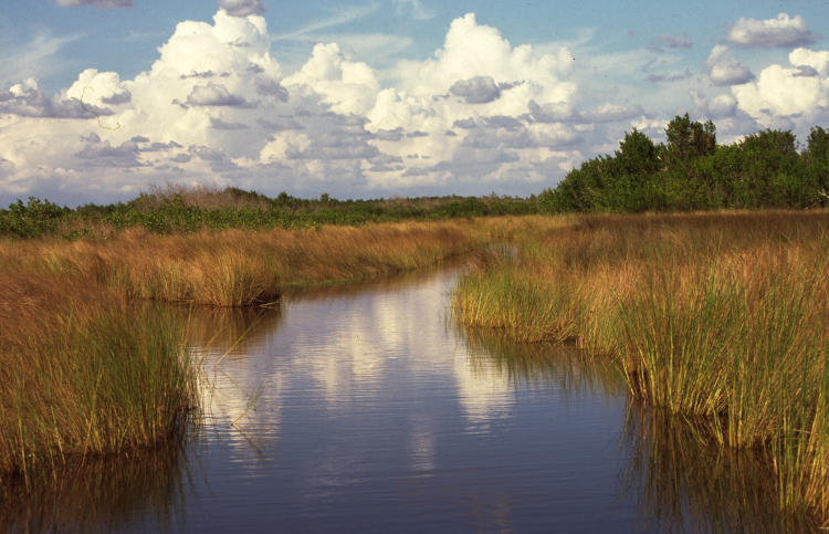
Some time back, I’d started noodling with a post idea and did a few slide scans to flesh it out, then never liked what I was producing and tossed it. But that gives us this slide, once again from a trip to Florida, representing the only image I think I have of ‘the Everglades.’

I mean, I have plenty taken within, but no others of it – nothing that shows the broader landscape, as it were. This one was taken from an airboat ride, one of the many that you can find advertised as you go along Rt 41, otherwise known as the Tamiami Trail because 41 runs from Tampa, south along the west/gulf coast, that cuts across the northern edge of the Everglades over to Miami. It’s a local route rather than an interstate, so it’s dozens of times more interesting than I-75 further north. On a previous trip I’d gone out on a snorkeling excursion to the coral reef near Key Largo, and on this one I was debating whether I’d do so again or take an airboat ride. Key Largo was several hours away, and I’d never been on an airboat, so it won out, but I have to say it was unimpressive. I’m sure airboats are fun if you’re at the helm, but when you’re just a passenger and don’t come across anything interesting, well, I can’t be too enthusiastic about them.
Still, I liked the feel, the representative example of the vast swamp (even when it doesn’t look too big here,) and those stacked and layered clouds mimicking the treeline were cool. And then, interested in the subtleties of their textures, I converted it to greyscale.

It took a little selectivity in the Curves function in GIMP to bring them out this way, but it’s making the most out of monochrome. Now, to me, it seems later in the day with a storm threatening, perhaps not the best time to follow any channels too far ahead. The clouds are no longer background but more dominant in the frame, almost palpable in their shapes, while the channel grasses are even more coarse-looking. This is not deceptive, either: we passed a little too close to some of the tall stands of grass on the airboat and they’re not good to encounter at speed.
By the way, if you’ve never done this, go check out the Everglades in Google Earth or Google Maps, just for the sake of it. The dearth of roads says a lot, but satellite view is plenty expressive.


