


N 26°20’19.30″ W 81°48’17.66″ Google Earth location
This one isn’t so much to show you a great place for photos, though it may work in that regard; most of the appeal is the sky though, which can occur anywhere. More, this was another of those self-challenges that I get up to, seeing if I can pinpoint a location that I visited just once in passing.
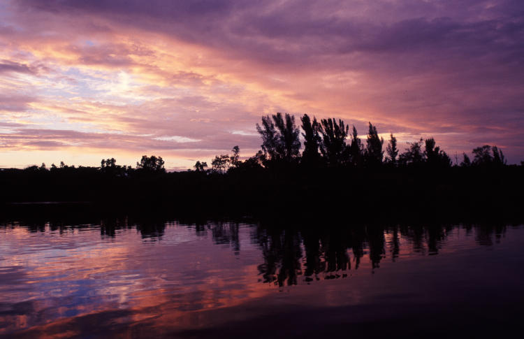
I’m pretty sure that this was on my birthday in 1999, during a tour of Florida while I still lived in NC. The common evening thunderstorm had rolled in while I was eating dinner at a Perkins Restaurant, and initial memory told me that it was in Fort Myers, but as I thought about it I recalled it was in Bonita Springs, the city a little south of Fort Myers where I was staying, because it was much cheaper while still being relatively convenient to Sanibel Island. The rain hammered, the thunder crashed, and I stalled over dinner, not wanting to go out in it, but it soon passed (as it usually does,) and I hopped into the car to head north. Immediately, the sky cleared into a moody collection of scattered clouds lit by the setting sun, and I figured I’d have to do something about it. The city wasn’t a good place, and I was hoping for a nice natural-looking area between Bonita Springs and Fort Myers, when I saw the bridge ahead and a turnoff almost immediately on my right, possibly marked with signs for a boat launch. I swung the car quickly into the parking lot, hopped out at the ramps, and hastily set up some frames.
I’m still unsure how I feel about this one. I like the colors, and how the cloud line matches the tree line, and even how the gentle ripples accentuate rather than disturb the reflection. But I also feel that it could have been stronger, had more of a focal point of something. No birds saw fit to pass through and give me something to work with, and the light was changing and fading rapidly, so this is what I had to work with. But I have indeed done better, by any objective measure.
Years (decades, really) later, I endeavored to pin the location down. I knew I was sticking to Rt 41 instead of the faster but far more boring I-75, and I knew the orientation of the river and ramp. It didn’t take long. Moreover, I even located the restaurant, not a kilometer due south at the major crossroads there – it’s now an Aqua Seafood Steaks and Raw Bar, but go into Street View and it’s still a Perkins. And if there remained any doubt in my mind, looking at one of the other frames that I took then settled it just ducky.
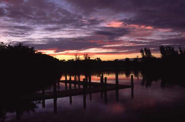
These were taken only minutes apart, but you can see how the sunlight has left the clouds now. More to the point, that L-shaped fishing dock is more than distinctive enough – with a few measurements and perhaps a little math, I could pin down to within a meter where I was standing on the other, straight dock.
But I can’t recall what table I was at for dinner. Getting old…